

Mapsvg – The Last WordPress Map Plugin You’ll Ever Need
/Year
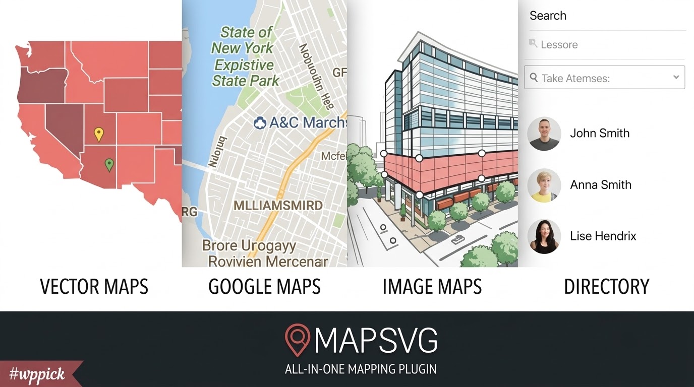
What is MapSVG and How Does It Transform WordPress Sites?
MapSVG is a robust WordPress mapping plugin designed to convert vector graphics, custom blueprint images, and standard geographic layouts into fully interactive, data-driven map experiences. Instead of relying solely on basic embedding tools, site administrators can connect maps directly to custom post types, external APIs, or CSV databases to display dynamic markers, clickable regions, and real-time directory filters.
Who Should Use MapSVG?
This plugin caters to web developers, digital agencies, and business owners who need tailored spatial data visualization. It is ideal for real estate agencies displaying property locations across regional layouts, retail chains building multi-branch store locators, municipal portals mapping community resources, and event organizers illustrating interactive venue blueprints.
Key Capabilities and Advanced Features
- Convert any custom JPG, PNG, or SVG image into an interactive vector map with clickable regions.
- Integrate seamlessly with Google Maps layers for standard geographic navigation and street-level views.
- Build advanced search filters and interactive directories that instantly update visible markers based on user criteria.
- Connect maps directly to WordPress custom post types for automated content synchronization and updates.
- Embed and configure maps visually using native widgets and blocks within popular page building environments.
Practical WordPress Use Cases
MapSVG solves complex visualization challenges across multiple industries. Retailers deploy it to create multi-location store finders with ZIP code radius searches. Real estate professionals use custom image maps to display floor plans or subdivision layouts where users can click individual units for pricing and availability details. Tourism boards utilize interactive regional maps to highlight local attractions paired with filterable directory lists.
Setup and Page Builder Compatibility
The plugin includes native widgets and blocks tailored for modern editing environments like Gutenberg and Elementor, providing live map previews directly inside the page editor. Data integration is handled through flexible sources, allowing administrators to map CSV files or database tables while maintaining secure handling of remote endpoints.
Why Choose MapSVG on WPPick?
MapSVG bridges the gap between static graphics and dynamic spatial databases, giving developers granular control over marker behavior, tooltips, and responsive scaling. Its comprehensive template system ensures that map directories match any custom theme design without requiring complicated custom JavaScript workflows.
Latest Version Context: Version 8.16.0
Version 8.16.0 introduces important administrative improvements and security hardening. Editing or replacing vector files no longer deletes associated region records whose IDs disappear, keeping orphaned rows available for safe data migration. Region label centering has been improved for better placement on complex shapes without visual flashing during load sequences. Additionally, REST API and remote CSV fetches have been hardened to restrict requests against private, loopback, or cloud-metadata hosts, while Google Sheets web-view links are now properly validated during imports.
Frequently Asked Questions
Can I use custom blueprint images instead of geographical maps?
Yes, MapSVG allows you to upload any standard image file, such as a floor plan or blueprint, and turn its vector outlines or specific coordinate points into clickable, data-driven interactive elements.
Does MapSVG integrate with WordPress Custom Post Types?
Yes, you can connect your map markers directly to any WordPress custom post type, enabling automatic updates whenever posts are published, modified, or removed.
Are Google Maps required to use the plugin?
No, Google Maps integration is completely optional. You can use vector maps, custom image files, or vector country and state maps independently without relying on external mapping services.
How do users filter locations on the map?
MapSVG features built-in filter builders that allow you to add search bars, drop-down menus, checkboxes, and radius sliders that dynamically update both the map markers and the adjacent directory list in real time.
Is MapSVG compatible with page builders like Elementor?
Yes, the plugin includes native widgets and blocks for modern page builders, allowing you to view and configure map layouts directly inside your page editing screen.
I. Download Limits & Account Benefits
- Free Downloads: Each email address receives 3 downloads per day for free products
- Upgrade Benefits: Purchase any paid product to increase your daily download limit by 3 for each paid product
- No Account Required: You can download immediately by receiving the download link via email
- Account Recommended: Create an account for easier access to your order history and direct update downloads
II. Understanding GPL vs Official Versions
Important: The products available on WPPick are GPL-licensed versions, which differ from official developer versions. Before purchasing, please read our comprehensive guide: Understanding GPL & Official Differences at WPPick
Key Points:
- GPL versions may not include premium support from original developers
- Updates may be delayed compared to official releases
- Some premium features might have limitations
- Always consider your specific needs and support requirements
III. Support & Assistance
We’re here to help through multiple channels:
- Email Support: Direct email assistance for all inquiries
- Live Chat: Real-time support during business hours
- Comprehensive Documentation: Detailed guides and tutorials
IV. Order Tracking
Access your complete purchase history and download links anytime: Order History
V. Account Access
New to WPPick? Login or Create Account to manage your downloads and orders efficiently.
VI. Refund Protection
We stand behind our products with a clear refund policy. Review our terms: Refund Policy
VII. Privacy & Security
Your data security is our priority. Learn how we protect your information: Privacy Policy
VII. Terms of Service
Understanding our service terms ensures a smooth experience: Terms of Use
Quick Tips for Best Experience
- Verify Compatibility: Check plugin/theme compatibility with your WordPress version
- Backup First: Always backup your site before installing new plugins or themes
- Test Environment: Consider testing on a staging site first
- Stay Updated: Regularly check for updates in your account dashboard
- Read Documentation: Review any included documentation for optimal setup
Need Help?
If you have questions about downloads, licensing, or need technical assistance, don’t hesitate to contact our support team. We’re committed to ensuring you have the best possible experience with WPPick products.
Ready to get started? Your download adventure begins with just one click!
- Replacing or editing an SVG no longer deletes region records whose IDs disappeared. Those rows stay as orphans so you can copy their data, then remove them from Regions → Settings → Clean orphan region records.
- Region labels: More reliable label centering (better placement on awkward shapes, no flash before styles load). Bundled SVG maps were updated with the new centers.
- Security / REST API: Hardened remote CSV and API fetches so user-supplied URLs cannot reach private, loopback, or cloud-metadata hosts.
- CSV import: Google Sheets web-view URLs are rejected; use a published CSV link instead.
- Admin: Stopped a map resize feedback loop that could keep resizing the preview.
- Elementor + Gutenberg: Added native integrations (Elementor widget and Gutenberg block) with live map preview directly inside the page editor, so you can see map updates while editing.
- Data sources: You can delete unused data sources from the admin (connected sources and region tables stay protected).
- WP Posts: Clearer Connect / Edit / Connected controls for data sources, and more reliable linking of maps to WordPress post types.
- Admin UI: Cleaner data source actions (icon buttons) and form layout tweaks.
- WP Posts / post types: Fixed empty or missing postType on legacy posts_* schemas so post filters and sync work correctly.
- Google Maps: Removed an incorrect viewport restriction that could block map interaction.
- Post publish/unpublish map sync: Map data now updates correctly when connected posts are published, unpublished, trashed, or restored.
- Directory item templates: Fixed rendering issues in directory item templates.
- Zoom to a single marker after filtering: Fixed the zoom behavior when filtering leaves only one marker visible.
- Region status colors: Fixed region status colors not applying correctly.
- Slovenia map calibration: Fixed the calibration of the Slovenia map.